Day 14, Feb 3: island hopping
If Antarctic were music it would be Mozart. Art, and it would be Michelangelo. Literature, and it would be Shakespeare. And yet it is something even greater; the only place on earth that is still as it should be. May we never tame it.
Andrew Denton (An Aussie adventurer)
Today is the second Saturday; the last island hopping day.
 Count down to Drake Passage … We sail around the tip of the Antarctic Peninsula, Weddell Sea in the Southern Ocean. Gearing up toward Whalers Bay, Drake Passage, and eventual return to Ushuaia – bottomed out, you could say.
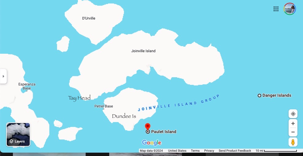
Continues from D’Urville Island (yesterday), according to my photos’ GPS, and ship’s information board, here is our route:
- Joinville Island at 7am (N of Dundee & Paulet), video
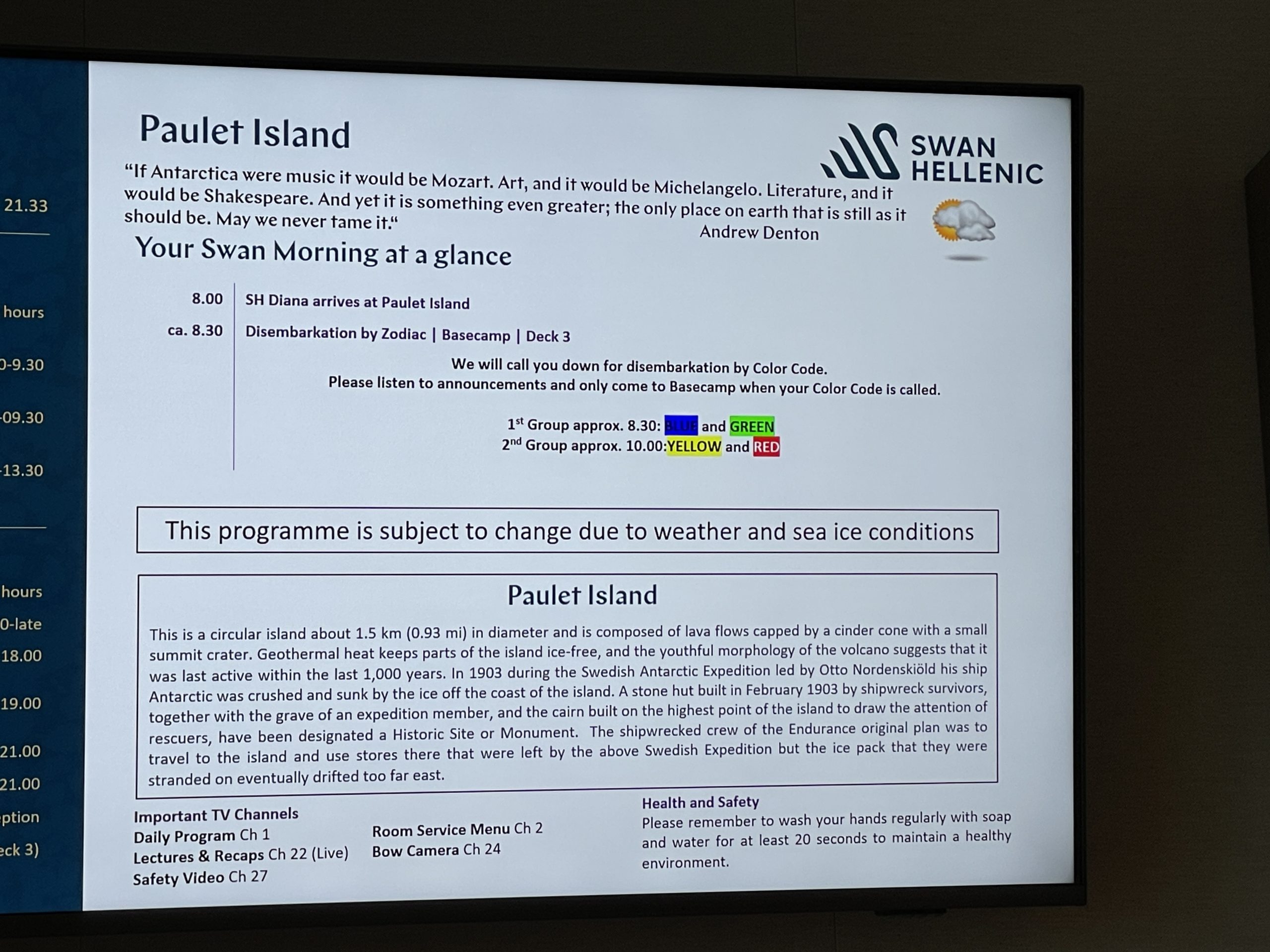
- Paulet Island by 8, per ship; zodiac begins 8:30, short/long
- Heroína Island at 10am (of Danger Islands, to the E) of Danger
- Tay Head at 1:30pm, per ship
On the map, from north to south (top down), the locations of these islands are:
- they’re all east (NE to SE) of Esperanza Base, the year-round Argentine research station in Hope Bay
- D’Urville is the northern most among these islands
- followed by Joinville Island
- followed by Dundee Island (wiki)
- followed by Paulet Island
- Heroína Island of Danger Island (wiki) is E of Dundee
Joinville Island (wiki) is the largest island in the Joinville Islands group (wiki). It was discovered during the 1838 French expedition, under Captain Jules Dumont d’Urville (1790-1842), who named it after François d’Orléans, Prince de Joinville (1818–1900), [the third son of Louis-Philippe, Duke of Orléans (1773-1850)], who was well known for his watercolor paintings and famous for bringing back Napoleon’s remains from Saint Helena.
… on Google Maps
4 minutes after the above video was taken, the next photo’s GPS shows Heroína Island (wiki), part of Danger Island. Ship‘s program indicates Paulet Island. The two islands are adjacent to each other (Paulet to the west) in the Weddell Sea, part of Southern Ocean.
The following two aerial pix are taken by ship’s photographer, of the island and our ship near by.
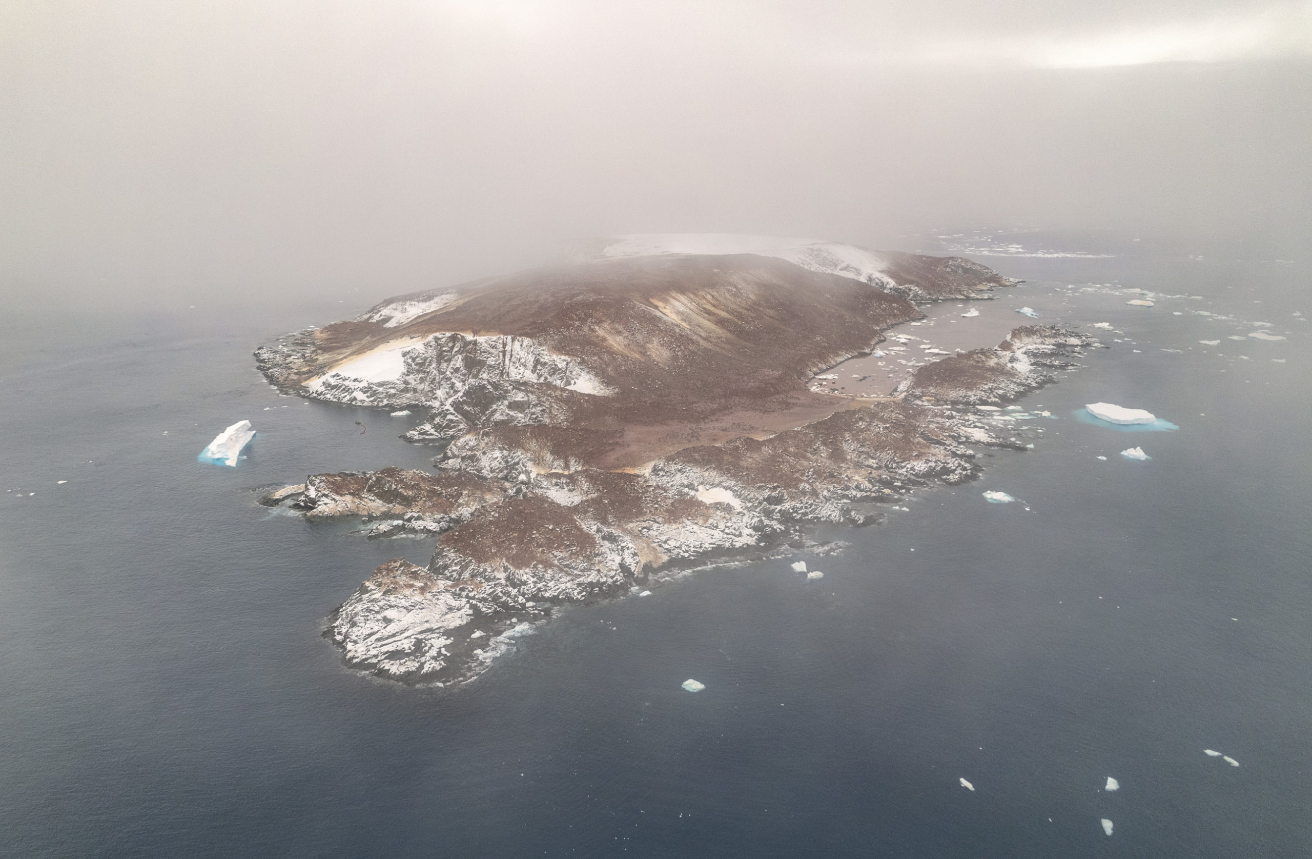
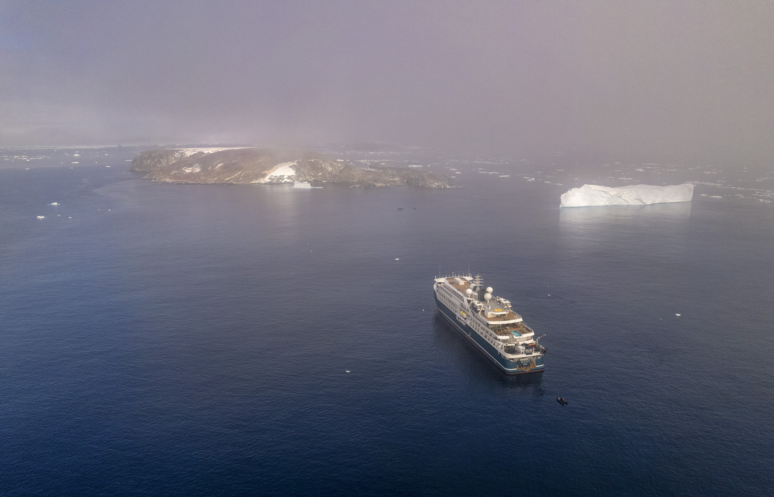
Paulet Island is a circular island about 0.93 miles (1.5km) in diameter, 2.8 miles SE of Dundee Island (wiki), off the north-eastern end of the Antarctic Peninsula. It’s composed of lave flows capped by a cinder cone with a small summit crater. Geothermal heat keeps parts of the island ice-free, and youthful morphology of the volcano suggest that it was last active within the last 1,000 years.
… more pix videos on Google Maps, TA
In 1903 during the Swedish Antarctic Expedition led by Otto Nordenskjöld (1869-1928) his ship Antarctic was crushed and sunk by the ice off the coast of the island. A stone hut built in Feb 1903 by shipwreck survivors, together with the grave of an expedition member, and the cairn built on the highest point of the island to draw the attention of rescuers, have been designated a Historical Site. The shipwrecked crew of the Endurance original plan was to travel to the island and use stores there that were left by the Swedish, but the ice pack that they were stranded on eventually drifted too Far East.
The large penguin colony, with 1.2 to 1.3 million mid-sized Adélie penguins, which only found in Antarctic continent, which was named after the wife of its discoverer Jules Dumont d’Urville (1790-1842). It was a rare endeavor when everything was named after the sponsors – usually their kings or queens.
This island is a popular destination for sightseeing tours.
The Adélie penguins’ diet is mainly krill and fish. The water surrounded the island is pink from their guano, and is smelly.
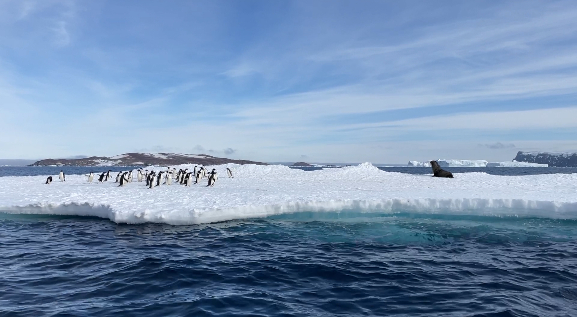 2 lazy seals and a group of penguins
“Let me see what are here,” one seal says. He looks up at us, “oh another group of clueless tourists,” then goes back to sunbathing.
The second seal to the right, gets restless, “let me to intimidate the little ones,” who then crawls forward. The group agile penguins act as if they’re flustered … “oh we’re so s-c-a-r-e-d.” Ha ha ha … imposing my little world view onto them -:)
2个海豹懒洋洋的晒太阳
“哦 看看谁来了” 其一说 “一群吃饱了撑的游客” 躺下换个姿势
另外一只说 “让我去搅搅小企鹅们”
右手边的小企鹅们看着心宽体胖的海豹 “哦 我们好害怕哦
好[偷笑]害[呲牙]怕[得意]”
他们的乐趣 the longer version
Danger Island is a group of small islands lays east to Joinville and Paulet, nears the tip of Antarctic Peninsular, (comprising Heroína Island, which shows up on my GPS). It’s so named because they’re well hidden among the ice till the ships almost upon it. They were discovered by British expedition under James Clark Ross (1800-62) in 1842.
Again, the tiki champagne bar -:) A little after 11am, as we’re returning to the ship for lunch, the kitchen staff come out with champagne. Unlike the Arctic which they used real stems, this time they use plastic … oh well, thanks anyway -:) … drinking before noon …well, it’s 5pm somewhere -:). OJ is offered too. Renato, the dinning room manager is in yellow jacket, who was on our Arctic cruise too.
Diana sails during lunch, arriving at Tay Head at 1:30. Archive.org has a little information on it, as well as wikipedia. Its name is derived from the Firth of Tay, a coast in Scotland.
Our yellow group is the last one to go on the zodiac, which is 4pm. … and the whale show starts almost immediately. The full version: the aerial photos are from ship’s photographer.
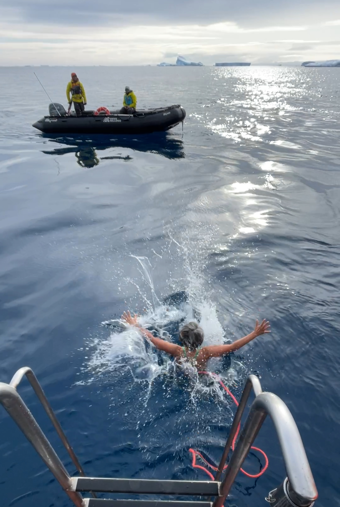
After the whales show, is the polar plunge: yes, I did it again
…

